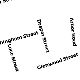
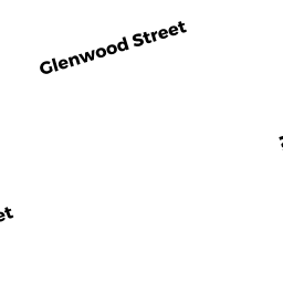
97 ARBOR RD
Owner Information
ARCHAMBAULT VICTOR J
97 ARBOR RD
LOWELL, MA 01852


Property Details
97 ARBOR RD is classified as a Single Family Residential (Colonial).
The primary structure on this property was built in 1977. There are 3,619ft2 of built area within this property. There is 1,837ft2 of residential/living space within this property. This property is listed as having 8 rooms.
97 ARBOR RD is valued at $397,200. The land is valued at $152,000 and the structures are valued at $234,900. There is an additional valuation of $10,300 on this property.
This property is in Zone SSF. Confirm with local Zoning Board authorities to ensure there are no overlays or other easements on this property.
The most recent deed for 97 ARBOR RD is recorded at the local registrar in Book 23962, Page 0095. 97 ARBOR RD was last sold on Friday, May 21, 2010 for $370,000.
Assessment data from fiscal year 2021.
Flood Data
According to the FEMA National Flood Hazard Layer, this property does not appear to be in a flood zone. It may also be in an area not yet reviewed. Nonetheless, confirm this information prior to taking any action.
To view the flood hazards around this property, create a FEMA "Firmette" Map of the area around 97 ARBOR RD.
Broadband Internet Providers
| Provider | Type | Bandwidth (mbps) | |
|---|---|---|---|
| Verizon New England Inc. | DSL | 7 | 0 |
| Comcast | Cable | 1000 | 35 |
| Viasat Inc | Satellite | 100 | 3 |
| HughesNet | Satellite | 25 | 3 |
| VSAT Systems, LLC. | Satellite | 2 | 1 |
| GCI Communication Corp. | Satellite | 0 | 0 |
Broadband service provider data from December 2020.
Adjacent Properties
- 102 DRAPER ST
Single Family Residential owned by COUILLARD DAVID A - 96 DRAPER ST
Single Family Residential owned by DELUCA ROBERT J - 109 ARBOR RD
Single Family Residential owned by MISSETT JAMES J - 87 ARBOR RD
Single Family Residential owned by JURISTA JANET M - 88 DRAPER ST
Single Family Residential owned by RONAN DE CASTILLERO ELIZABETH